Why The Platzertal Valley is Worth Protecting
For the expansion of the Kaunertal power plant by TIWAG (Tyrolean Hydro Power AG), the pumped storage power plant (PSKW) Versetz and an additional reservoir with a capacity of 42 million m³ are to be built in the Platzertal (1). Various storage variants in different high mountain valleys were investigated for the expansion of the existing power plant at the Gepatsch reservoir, and their suitability as a potential upper-stage reservoir was assessed (2). Components of this site assessment and evaluation included, among others, the topographical suitability of the locations, their proximity to and elevation relative to the Gepatsch reservoir, accessibility, the impermeability of the storage area, the stability of the slopes, and the potential for gravitational mass movements (rockfalls, debris flows, avalanches) in the area of the reservoir. In addition to the Platzertal storage site, storage variants at Taschach in Pitztal and Fernergrieß in Kaunertal were also examined.
Due to the engineering-geological and constructional conditions, the Platzertal location was ultimately selected (3). With TIWAG’s plans to construct a dam and convert the valley into a reservoir, the popularity of Platzertal has increased significantly.
TIWAG is currently preparing the necessary documents required for the Environmental Impact Assessment (EIA). The EIA will assess the effects of the power plant project and derive compensatory measures (4).
There are many different aspects that argue against the Platzertal storage site, aside from the framework conditions that led to the decision for this site. In this blog post, we aim to explain which characteristics and features make the Platzertal worth protecting. We will consider the geomorphological, hydrological, ecological, and cultural-historical aspects of Platzertal.
Why is Platzertal Worth Protecting?
Geomorphological Features
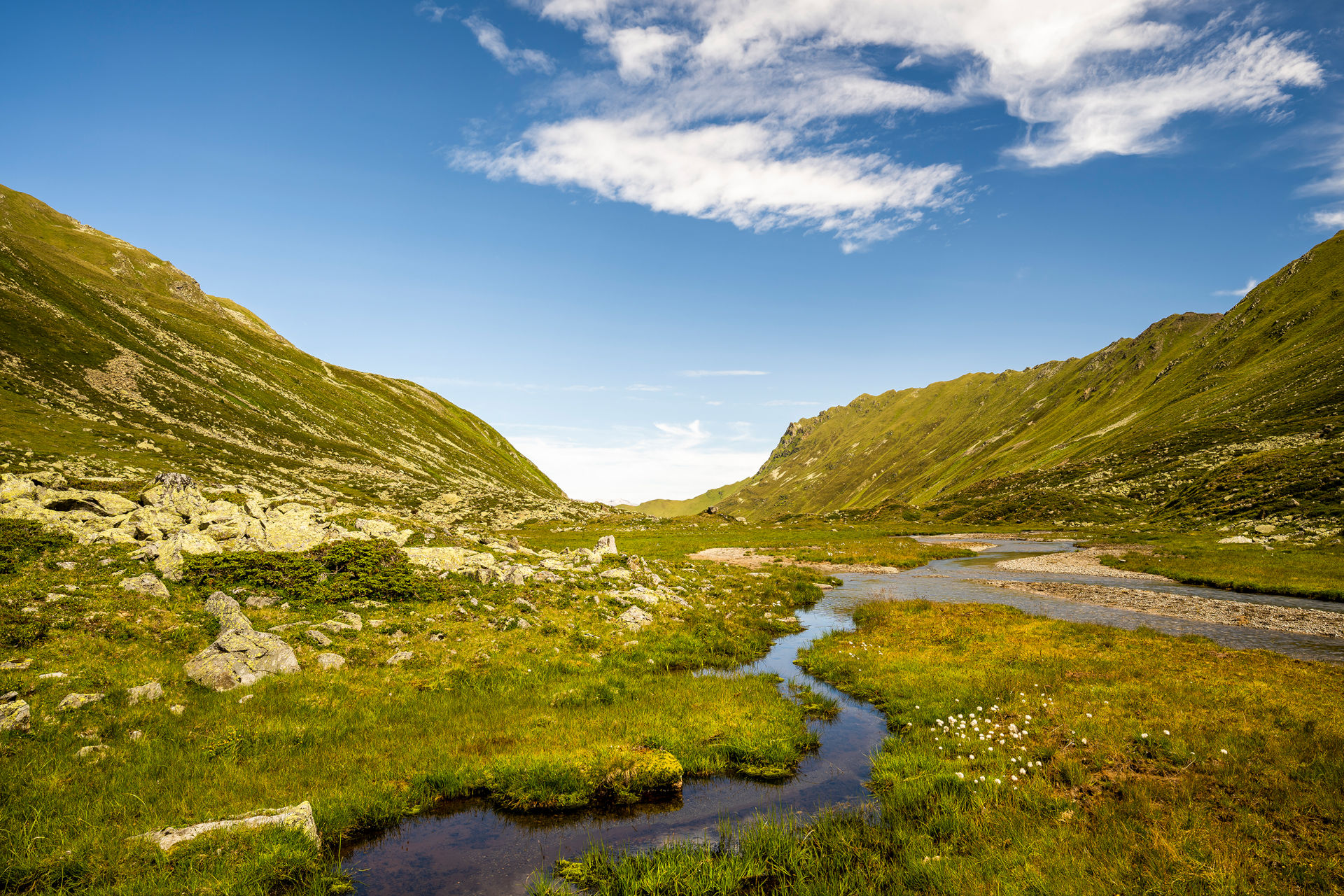
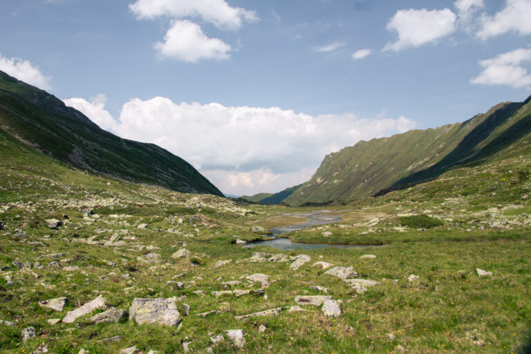
The Platzertal valley is located in the western part of the Ötztal Alps, to the west of the Kaunertal valley. It is a high mountain valley, glacially shaped and overlaid by post-glacial erosion and accumulation processes. The geological base rock is covered by glacial, periglacial, and glaciofluvial sediments, as well as slope debris and debris flow deposits. The glacial sediments consist of a several-meter-thick terminal moraine. The glaciofluvial sediments are related to the melting of the glacier during the late glacial period (2).
The planned reservoir is situated in a wide valley floor, with steep flanks, and glacial trimlines marking the abrasion boundary of the former glacier. Remnants of the glacier’s lateral and terminal moraines are still visible, offering insights into past glacial movements (2). The moraine fields in the Ötztal Alps are valuable climate archives, allowing reconstructions of the climate as far back as the early Holocene. The moraine fields and late-glacial deposits in the small high valleys of the western Ötztal Alps, such as in the Platzertal, are particularly well-preserved and abundant compared to the rest of the Eastern Alps, with high diversity and detail. The moraine systems of formerly glaciated Alpine valleys have been studied for many decades and are of great importance for the analysis and reconstruction of climatic changes and glacier development (5).
Hydrological Features
North of the Platzerspitze, at 3,098 meters, the Platzerbach river originates at around 2,500 meters. From there, it flows about 5 km northward, past the Platzer Alm and an old ore processing plant (4). After a total length of around 10.5 km, the Platzerbach flows into the Tösnertalbach, which then merges with the Inn River about a kilometer downstream (6). The Platzerbach has a catchment area of 17.7 km² (7). The river’s condition is rated as “good”. The classes range from “1 – very good” to “5 – poor” (8). The morphology of the bank dynamics is classified as “natural” for all sections of the Platzerbach. The morphology classes range from “1 – natural” to “5 – piped, dry” (9). In the river conservation plan, the majority of the Platzerbach is classified as “highly worth preserving” with “very high” natural value. Only the last sections before merging with the Tösnertalbach are considered “worth preserving” with “high” natural value. The sections of the Platzerbach with very high natural value refer to the upper sections before the Platzerbach flows westward (10). However, these upper sections are precisely the ones that would be directly affected by the construction of the reservoir. Hydrological assessments of the Platzerbach indicate that Platzertal is an undeveloped, natural watercourse in good condition. Also of hydrological significance are the springs and spring protection areas in Platzertal, which are listed in the Tyrolean Spring Register, such as the “Lower and Upper Platzeralm Springs” (5).
Ecological Features
In 2023, the WWF published a study on high-alpine peat bogs in Austria. The study identified, mapped, and digitized 158.1 hectares of bogs and wetlands in alpine high valleys. The results showed that Platzertal contains the largest, largely untouched complex of peat bogs and wetlands in the Austrian Alps. The peat area in Platzertal covers 20.42 hectares and is not yet under protection (11, 12).
Intact peat bogs are crucial for ecosystems, climate, and biodiversity. They absorb and store carbon dioxide long-term, making them significant carbon storage sites and carbon sinks. Hydrologically, peat bogs are important for regulating water balance, filtering water, and influencing groundwater formation (11, 13). Furthermore, peat bogs are habitats for unique and rare species of plants and animals, including in the Alps. In Austria, peat bogs are among the most endangered habitats. Already, 90% of the original peat bog areas have been lost and cannot be restored as habitats. Of the remaining 10%, 90% have been heavily disturbed. Platzertal is among the less than 1% of original peat bog areas that are still intact (12).
Due to climate change and its effects, including altered precipitation patterns, peat bogs are under severe threat. In addition to climate change, land use changes, land consumption, altered hydrological conditions, and nutrient changes threaten the condition of peat bogs (14). Especially hydropower and tourism projects have been associated with the increasing loss of intact peat bog areas (11). Despite the alarming numbers regarding the deterioration and loss of peat bogs, exceptions continue to be granted for interventions and destruction in peat bog areas (14). The peat bog complex in Platzertal is threatened by the planned expansion of the power plant. Over 6 hectares of peat bogs would be flooded if the planned dam, about 120 meters high, were constructed (11). The construction of the reservoir and dam also requires extensive infrastructure, such as truck-accessible roads and construction tunnels from Kaunertal to Platzertal (5). This expansion threatens the largest planned destruction of peat bogs in Central Europe. Together with scientists and with support from the “IG Moorschutz”, WWF has applied for the designation of the peat bog landscape in Platzertal as a nature reserve. As a directly designated nature reserve, Platzertal could be permanently preserved (11). To protect peat bogs and their stored carbon reserves, it is essential that intact peat bogs are actively conserved and disturbed ones are renaturalized (14). A comprehensive and systematic inventory of intact peat bog and wetland areas in the high valleys of the Alps is also crucial. This would make a significant contribution to peat bog, nature, and climate protection, as well as biodiversity conservation (12). A WWF study, analyzing 27 case studies, showed that peat bog protection in Austria currently has significant shortcomings and does not comply with the guidelines of the Alpine Convention’s Soil Protection Protocol (14).
Cultural & Historical Features
In addition to geomorphological, hydrological, and ecological features, Platzertal also has cultural and historical aspects that make the valley unique. On the one hand, traces of former pastoral activities can be found, and on the other hand, remnants of former mining activities, once conducted in Platzertal, are present. The documentation of cultural assets in the area of the planned power plant constructions is also part of the EIA, which is required for the project. Cultural assets can include historical buildings, paths, small monuments, or yet-to-be-researched areas with archaeological potential that need to be protected and preserved (4).
Historical Pastoralism in Platzertal
The remains indicating historical pastoralism in Platzertal since modern times are mostly in a state of significant decay and are therefore much less noticeable than traces of past mining activities. Traces of former pastoralism in Platzertal include, for example, dilapidated huts, alpine pastures, or mountain hay barns, abandoned irrigation channels (“Wasserwaale”), or shepherd’s shelters. The latter were often found near large boulders that provided protection from the weather. Remains of stone walls that marked grazing boundaries or protected livestock from falling were also common. Historical remains also include stone piles or walls, which were created by stones and blocks that ended up on grazing land due to falling processes and were stacked to keep the grazing areas clear of rocks. All of these remains and traces of former land use and settlement are of cultural-historical interest because they can provide insight into the historical pastoralism and lifestyles of the alpine people. This information can be reconstructed and dated with the help of archaeological excavations (4).
Historical Mining in Platzertal
Platzertal still has traces of historical mining. The ores worth extracting in the Platzer and Bergl valleys mainly consist of lead, zinc, and copper ores. The lead ore has a high silver content, up to 1,000 grams per ton (4). Mining in the Platzer and Bergl valleys can be traced back to the 15th century. Between 1610 and 1884, mining had to be suspended (15). This interruption is associated with the climatic deterioration known as the “Little Ice Age”, which caused glaciers to advance and cover the valley with the Bergler Ferner glacier. After this climate-induced break, mining was resumed. Mining was halted again in 1910 because, despite the high silver content in the ore, the extraction was no longer economically viable due to high extraction and transport costs. The existing facilities were left to decay. Attempts to restart mining were made in 1923-25 and 1950 but failed because no profits could be made due to the remote location (4). Mining in Platzertal is not an isolated case. Many other mines in Tyrol were similarly too remote to cover their costs due to low yields (16).
The traces of historical mining include the ruined old ore processing plant, the foundations of the valley station, and the remains of the mast foundations of the former material cable car, as well as the associated mountain station. Both the buildings and the ore processing plant are protected as historical monuments (4). The high historical value of the mines in Platzertal is especially linked to their altitude. The mines in Platzertal and the neighboring Berglertal reached altitudes of up to 3,000 meters, making them some of the highest mining operations in Europe and giving them significant cultural-historical value. In 2007, the “Verein Bergwerk Platzertal” was founded to preserve and promote the mining site for tourism. In 2013, the association, together with the Federal Monuments Office, started a revitalization project, which will take several years and include the restoration of some facilities. The cable car station was renovated from 2015 to 2017. Subsequently, the staff building below the old tunnels was restored. The restoration of the ore processing plant is still pending (15, 16). The restoration efforts aim to return the buildings to their original state as much as possible (4).
Conclusion
Platzertal is a very special place in many respects. Its geomorphological, glacial, and periglacial history, hydrological and ecological features with the Platzerbach stream and the largest, largely untouched peat bog and wetland complex in the Austrian Alps, as well as traces of past land use and mining activities with cultural-historical significance, are just a few examples highlighting the uniqueness of Platzertal. All these features are currently threatened by the plans of TIWAG. Therefore, it is very important that Platzertal is protected to prevent the development and flooding of the valley, and to safeguard its rich natural and cultural heritage. It is critical to weigh the benefits of renewable energy projects like this one against the potential irreversible damage to the environment, and to ensure that Platzertal remains protected for future generations.
Sources & Links
- Neubarth, J. (2023a): Energiewirtschaftliche Einordnung Pumpspeicherkraftwerk Versetz mit Speicher Platzertal.
- Zanon, R. und Pergher, L. (2013): Geologische Evaluierung hochalpiner Speicherstandorte in Tirol/Österreich. In: 19. Tagung für Ingenieurgeologie.
- Perzlmaier, S., Hofer, B., und Holzmann, M. (2012): Aspects of engineering geology concerning the selection of a site for the upper stage reservoir for the Kaunertal power plant expansion project / Ingenieurgeologische Aspekte bei der Standortwahl für den Oberstufenspeicher des Projekts Ausbau Kraftwerk Kaunertal. In: Geomechanics and Tunnelling, 5(5), 473-484.
- Weishäupl, B. (2015): Das Platzertal und seine Spuren aus früherer Weidewirtschaft und Bergbau. In: Tiroler Heimatblätter, 2(15), 83-88.
- Landmann, A. (2013): Wildnisareal Ötztaler Alpen. Naturräumliche und naturkundliche Besonderheiten. WWF Österreich.
- Land Tirol (2023): Gewässernetz Tirol. Online unter: https://www.data.gv.at/katalog/dataset/land-tirol_gewssernetzintirol#resources (Stand: 27.06.2024).
- Land Tirol (2024): Gesamtgewässernetz – Basiseinzugsgebiete. Online unter https://www.data.gv.at/katalog/dataset/13671fcf-a8ed-4f4b-91f1-74a7a01cca22#resources (Stand: 27.06.2024).
- Land Tirol (2022): Zustand Oberflächenwasserkörper 2021 Tirol. Online unter: https://www.data.gv.at/katalog/dataset/2830d11a-0754-4f81-8184-e63a0ffd497e#resources (Stand: 27.06.2024).
- Land Tirol (2023): Gewässer-Morphologie Tirol. Online unter: https://www.data.gv.at/katalog/dataset/5d7410c6-290d-4e43-8f20-b87d18138c71#resources (Stand: 04.07.2024).
- Land Tirol (2019): Naturschutzplan Fließgewässer Tirol. Online unter: https://maps.tirol.gv.at/synserver?user=guest&project=tmap_master&view=natur_natschutzplan (Stand: 04.07.2024).
- WWF Österreich (2023a): Größter unberührter Moor-Komplex im Platzertal entdeckt. Studie erfasste bisher unbekannten Moor-Reichtum in Österreichs Alpen. Online unter: https://www.wwf.at/artikel/groesste-unberuehrte-moorflaeche-im-platzertal-entdeckt/ (Stand: 27.06.2024).
- Schwienbacher, M. (2023): Hochalpine Moorlandschaften in Österreich. Verbreitung – Naturnähe – Bedeutung.
- WWF Österreich (2023b): Moorschutz im Alpenraum. Online unter: https://www.wwf.at/artikel/moore-im-alpenraum/.
- WWF Österreich und ÖKOBÜRO (2022): Moorschutz und alpiner Bodenschutz. Rechtliche Bewertung und Handlungsbedarf aus Sicht der Alpenkonvention.
- Verein Bergwerk Platzertal (o.J.): Bergwerk Platzertal. Online unter: http://www.bergwerk-platzertal.at/ (Stand: 23.06.2024).
- Weishäupl, B. (2021): Anthropogene Strukturen im Tiroler Hochgebirge. In: Forschungsberichte der ANISA für das Internet, 2(21).
Header image: Sebastian Frölich


